
Perception at the edge. Camera, LiDAR and sensor streams are interpreted locally on autonomous nodes.
Many sensors. One shared understanding.
Autonomous edge nodes process local observations and synchronize the parts of a digital world they need to share — enabling a distributed representation of real environments.
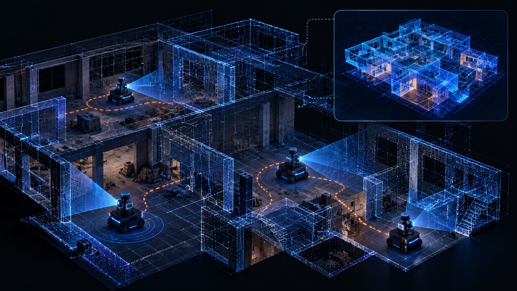
How the technology works
01 / Observe
02 / Synchronize
03 / Understand
One environment. Multiple independent perspectives.
Each sensor node perceives its local part of the world. The mesh exchanges structured observations so other nodes can update a shared situational model.
Share structured events. Relevant state, provenance and observations are exchanged under network policy.
Maintain a shared twin. Connected nodes construct and update their representation of the environment.
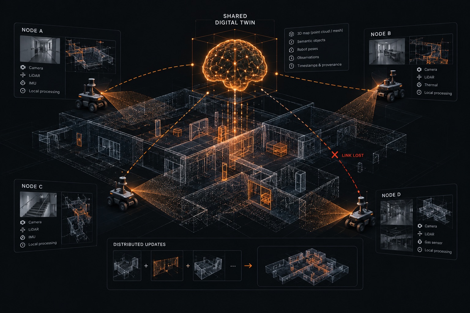
Beyond sensor fusion: distributed, resilient state.
DAI Digital Twin is designed to enable independent AI nodes to maintain a shared understanding of their environment — even when they use different sensors, experience unstable connections, or temporarily operate offline.
Each node processes observations locally and synchronizes relevant updates with other nodes, helping the network maintain a consistent digital representation of the physical world.
Our research focuses on:
- Distributed synchronizationkeeping shared information consistent across independent nodes.
- Structured observationsexchanging meaningful data with timestamps, confidence levels, and source information.
- Resilience and recoverymaintaining local autonomy during network disruptions and restoring synchronization when connectivity returns.
From the lab
A working idea you can actually see.
Our research combines large-scale virtual network simulations with physical experiments using autonomous AI nodes, robots, and drones.
Robotic digital twin experiments
In our laboratories, we are exploring how autonomous robots equipped with DAI Nodes can map their surroundings, exchange spatial data through peer-to-peer connections, and collaboratively maintain a shared digital twin of their environment.
Large-scale network simulations
We are developing and testing virtual networks of over 1,000 AI nodes that exchange data, synchronize their states, and collectively build a shared digital representation of the world. These simulations help us study network scalability, coordination, and resilience under different conditions.
Distributed drone networks
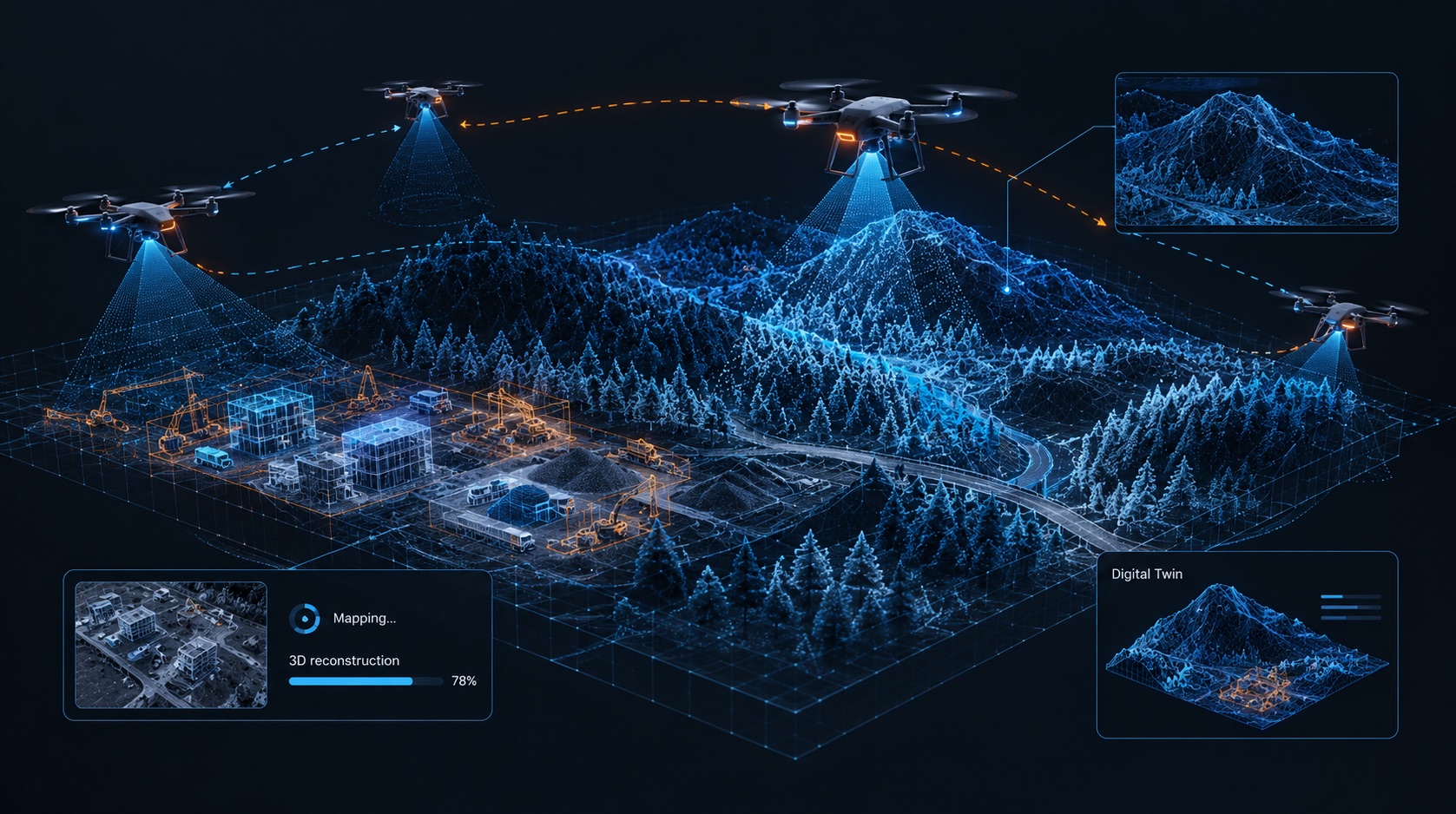
In parallel, we are investigating P2P sensor data exchange between AI nodes mounted on drones patrolling open areas. Our goal is to enable autonomous aerial systems to share observations and collectively build and update a digital representation of the terrain without relying on a central processing server.
Real-world applications
Shared awareness where it matters.
The same coordination layer can support multiple types of distributed physical-world intelligence.
Civil industry
Smart construction and site analytics
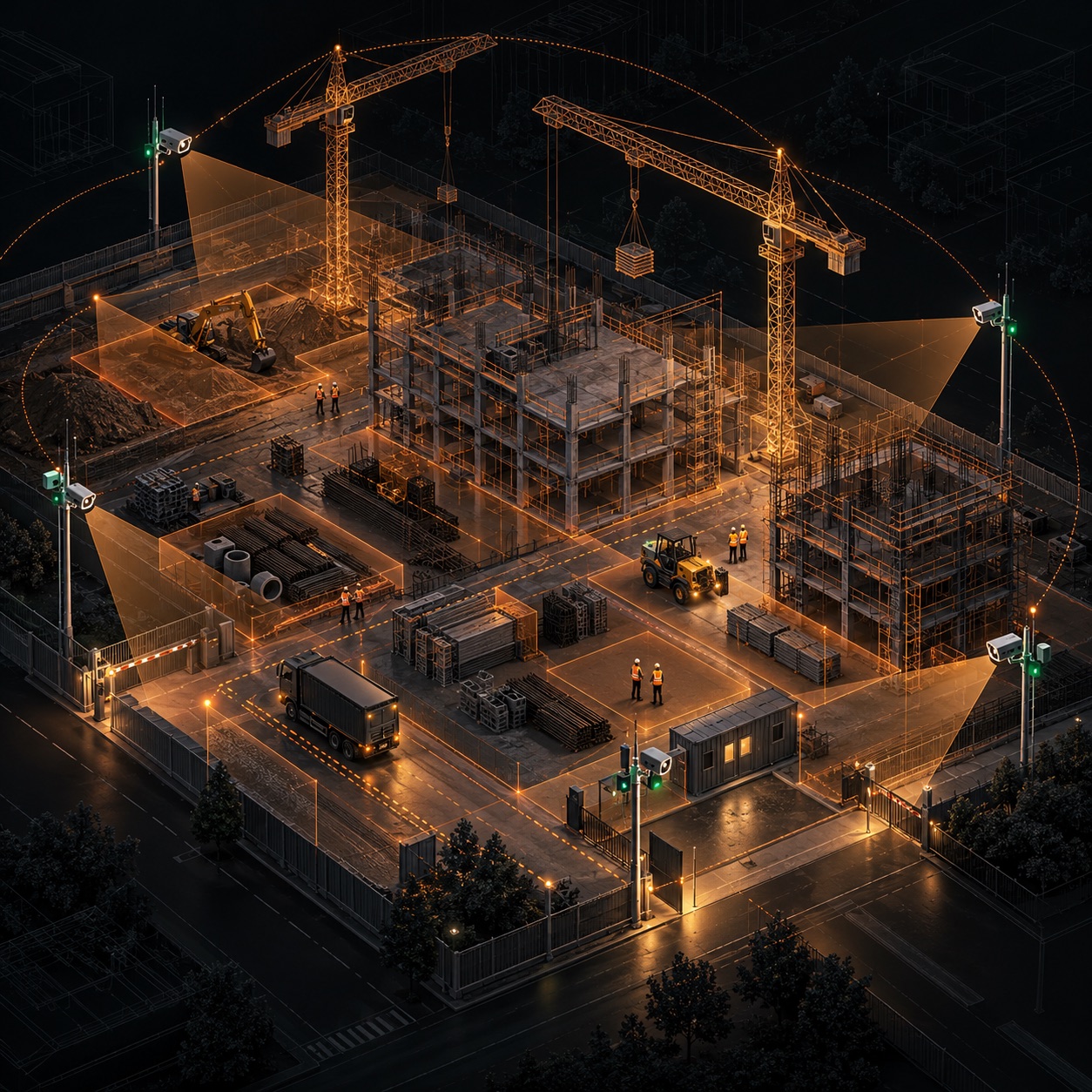
A DAI Node on the site can join cameras, sensors, BIM and the schedule into one view: what is happening, what should be happening, and what to do next.
Cameras, drones, dust and noise sensors, access control and machine telematics feed a node installed on the site. It reads that live picture together with BIM, drawings, the programme, deliveries and safety rules.
From there the system can compare the plan with the site, warn before a delay or an incident, and raise an alert or a task. Separate agents can watch safety, progress, logistics, equipment, after-hours security and management reports.
Video can stay on site. Only the events the project allows are sent out. A manager can ask what the risks are today, why a floor is behind, or whether tomorrow's concrete pour is ready.
Dual use / autonomy
Ground swarm coordination
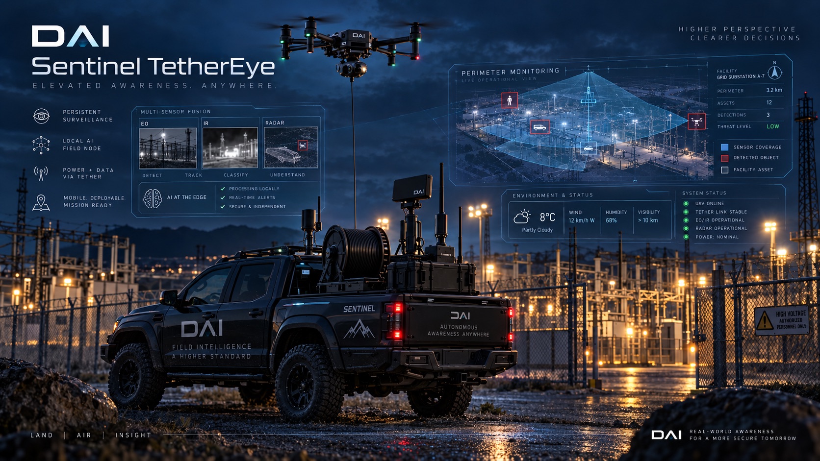
Ground vehicles, robots and tethered drones can share one picture of a building or a site, and hand a track from one unit to the next.
Each platform watches its own sector and keeps a local copy of the world. When a robot maps a room, or a vehicle spots movement, the others receive a compact update rather than a raw video stream, and can reuse that map instead of exploring it again.
The same layer can support indoor rescue and the protection of a site, or reconnaissance on the ground. A tethered drone or a mast gives a second, higher view, while the ground units stay linked by a peer-to-peer mesh.
A laboratory demonstration has shown a shared digital twin between two physical nodes. Autonomous navigation of a second robot, and a full fielded swarm, are the next step.
Cities / critical infrastructure
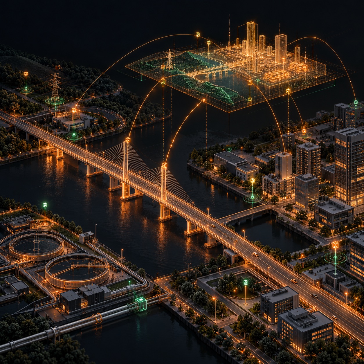
Smart City Green Hub
An autonomous hub can bring solar power, local AI, connectivity and EV charging to a street, a remote site or a piece of critical infrastructure, without waiting on a new grid connection.
Cameras, road and parking sensors, and if needed radar or LiDAR, feed the hub. It counts traffic, spots jams and free parking, and sends the city only the results, not every video stream.
The same station can watch forests, rivers and remote infrastructure for fire, flood and air-quality anomalies, and keep working if the grid, the mobile network or the main internet fails. Mesh links and a satellite backup stay up for municipal and emergency teams.
Solar panels and batteries run the node. Spare energy can charge electric vehicles, so one site is AI infrastructure, a mobility sensor and a charging point.
Dual use / autonomy
Coordinated drone swarm
A swarm of drones can patrol together and keep one shared map of the ground, without a central server.
Each aircraft processes its own camera, LiDAR or other sensors and shares structured observations with the rest of the swarm. Together they update a terrain twin, so a drone that joins later, or loses a link, can pick up the common picture.
Joint patrol can cover a border, a disaster zone or a contested area. The watch passes from one aircraft to the next, instead of each one starting from a blank map.
The same coordination can support search and rescue or the protection of infrastructure, and reconnaissance from the air.
Early access / network beta
Help test the first physical DAI-MESH network.
We are progressing from simulations and prototypes toward real-world distributed inference. Join the early interest list as a user, compute contributor or private-network partner.